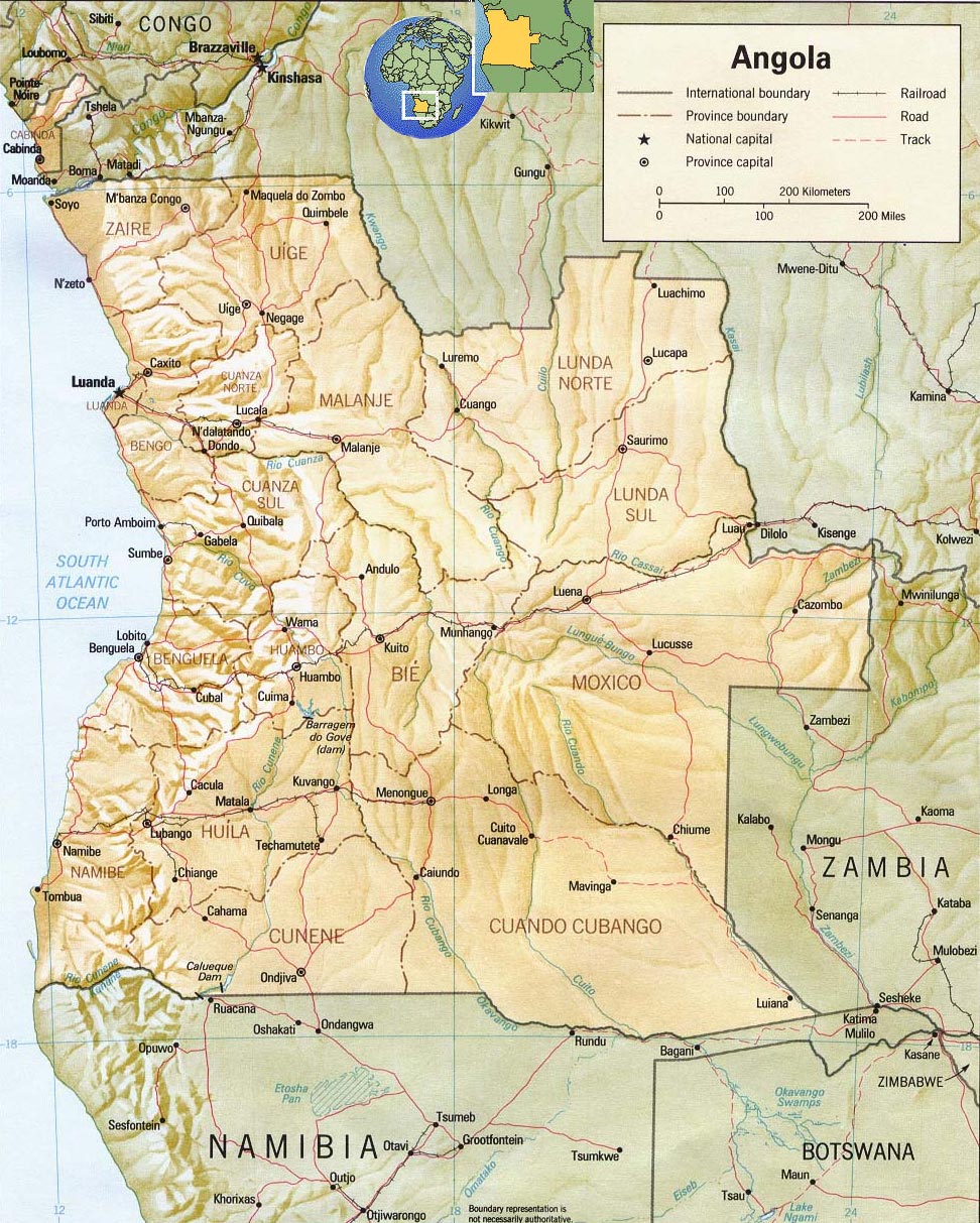
Angola Map
Angola is a country in southwestern Africa, bordering the Atlantic Ocean. Until 1975 it was ruled by Portugal and was sometimes called Portuguese West Africa. Angola became independent in 1975 after almost 15 years of war waged by Angolans against Portugal.
Today, it is the Republic of Angola. The capital and largest city is Luanda. Portuguese remains Angola’s official language and is widely spoken in the country. Angola is potentially one of the richest African countries, although poverty is widespread. The country has petroleum resources, as well as hydroelectric potential, fertile farmland, and diamonds and other mineral resources.
Angola is the seventh largest country in Africa, covering an area greater than France and Spain combined. It is bordered on the north and east by the Democratic Republic of the Congo, on the east by Zambia, on the south by Namibia, and on the west by the Atlantic Ocean. Also part of Angola is the territory of Cabinda, a small enclave located on the Atlantic coast north of the mouth of the Congo River and separated from the rest of Angola by a small strip of territory belonging to the DRC.

Source: U.S. Central Intelligence Agency.

|
|
Copyright © Geographic Guide - World in Pictures. African Continent. |
All rights reserved |