Cameroon Map - Africa
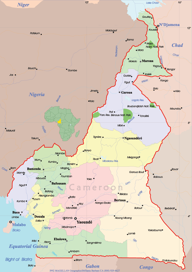
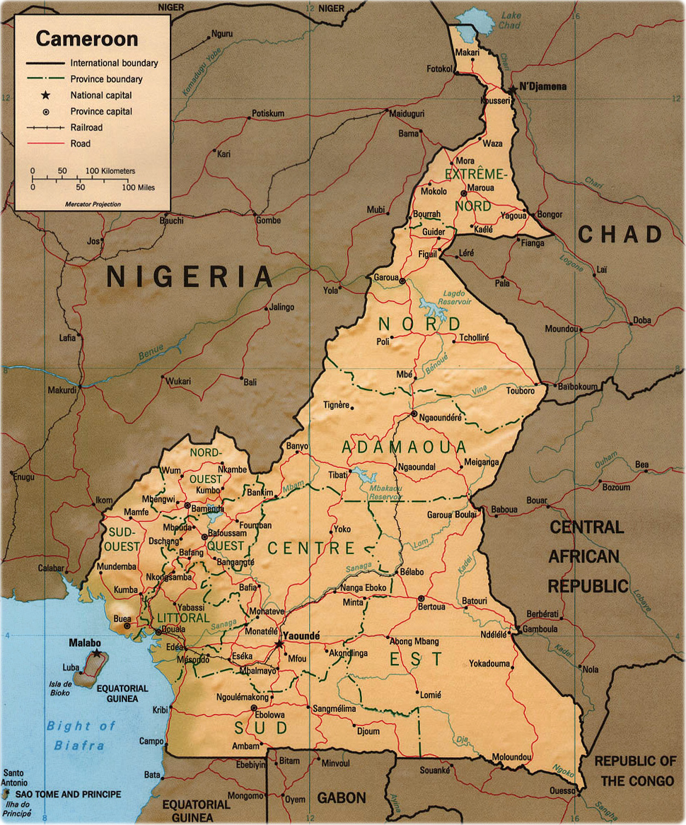
Cameroon is a country in western Africa, bounded on the north by Lake Chad; on the east by Chad and the Central African Republic; on the south by the Republic of the Congo, Gabon, and Equatorial Guinea; and on the west by the Bight of Biafra and Nigeria. The country is shaped like an elongated triangle, and forms a bridge between West Africa and Central Africa. The country has a total area of 475,442 km². Yaoundé is the capital, and Douala is the largest city.
|
Copyright © Geographic Guide - Maps of African countries. |
Map: U.S. CIA 1998. Map Cameroon, Federal Republic.
Cameroon Map - Africa