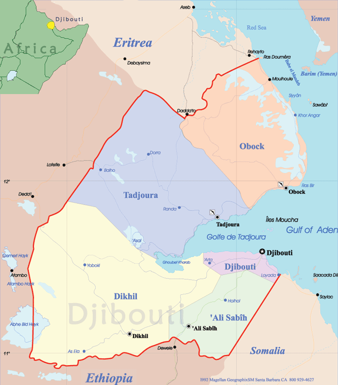
Djibouti Map - Africa
Djibouti is a country in northeastern Africa, located at the strait of Bab el Mandeb, which links the Red Sea with the Gulf of Aden. It takes its name from its capital and only large city, Djibouti. Located at the intersection of trade routes connecting the Indian Ocean with the Mediterranean Sea, and Africa with the Middle East, Djibouti has long been a cultural and commercial crossroads. The republic of Burundi has seven provinces: Bubanza, Bujumbura Mairie, Bujumbura Rural, Bururi, Cankuzo, Cibitoke, Gitega, Karuzi, Kayanza, Kirundo, Makamba, Muramvya, Muyinga, Mwaro, Ngozi, Rutana and Ruyigi. The capital is Bujumbura. It is located in central Africa, east of Democratic Republic of the Congo. There is a lake port in Bujumbura (Lake Tanganyika).

|
Copyright © Geographic Guide - World in Pictures. African Continent. |
