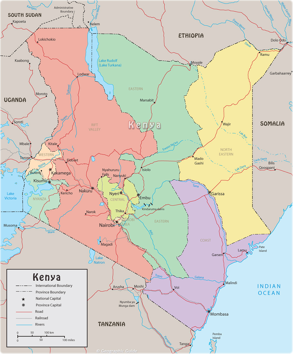
Map of Kenya
Kenya is a republic in East Africa. It has a varied landscape of plateaus and high mountains and is home to many different ethnic groups. Kenya gained independence from The United Kingdom, in 1963, and has been a republic since 1964. It is bounded on the north by South Sudan and Ethiopia, on the east by Somalia and the Indian Ocean, on the south by Tanzania, and on the west by Lake Victoria and Uganda. Nairobi is the capital and largest city.
Kenya’s largest lake, excluding Lake Victoria on its western border, is Turkana, in the northwest. Smaller lakes, including Lake Baringo, Lake Nakuru, Lake Naivahsa, and Lake Magadi, lie in or near the Eastern Rift. The country’s major rivers include the Tana and Galana in the east, and the Kerio, Turkwel, and Nzoia in the west. Parts of each of these rivers are navigable by small vessels, but only the Tana is used by larger boats.
Kenya has a total area of 582,646 km². The equator passes through the middle of the country. Kenya’s maximum length from east to west is about 890 km, from north to south it is about 1,030 km. The country’s main natural resource is its land, of which 9 % is currently cultivated. Almost all of the agricultural land is located in the south, as the northern two-thirds of the country is mostly desert or semidesert. Kenya does not have significant mineral deposits. Forests constitute approximately 6 % of Kenya’s land area. Kenya’s rivers provide hydroelectricity.
|
Copyright © Geographic Guide - World in Pictures. African Continent. |

