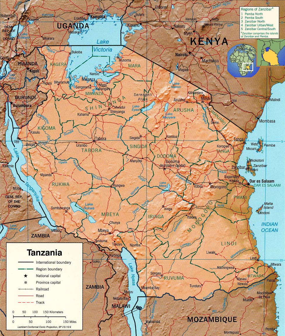
Tanzania Map - Africa
Map source: U.S. Central Intelligence Agency.

Tanzania is a country in Eastern Africa, bordering the Indian Ocean, between Kenya and Mozambique. Dar es Salaam is the administrative capital and Dodoma is the legislative capital. Tanzania has border with Uganda, Kenya, Uganda, Burundi Rwanda, Zambia and Mozambique.
|
Copyright © Geographic Guide - World in Pictures. African Continent. |
