Images of Uruguay
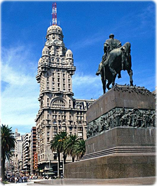
José Artigas monument in Montevideo (Plaza Independencia), the capital of the country.
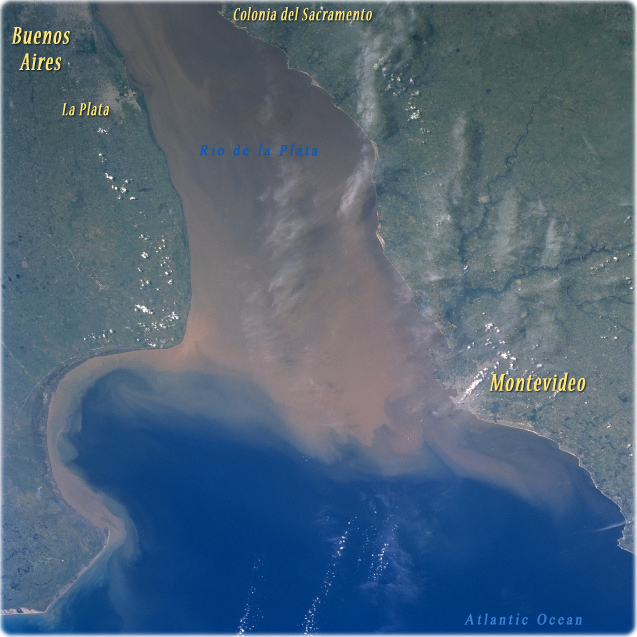
Rio de la Plata, Uruguay (January 1998 - NASA). The Rio de la Plata, a large estuary, is located between Argentina (left) and Uruguay (right). The estuary of the Rio de la Plata is one of the largest in the world. It receives runoff from five South American countries (Argentina, Uruguay, Brazil, Paraguay, and Bolivia). The extensive sediment plume (muddy looking water) in the Rio de la Plata seems to be a normal condition of the river. There is a constant mixing zone where the sediment-laden fresh water meets the salty waters of the southern Atlantic Ocean. The cluster of lighter colored areas near the top left corner of the image indicates the location of the city of La Plata and the eastern edge of the Argentine capital of Buenos Aires. The general location of the capital and largest city in Uruguay, Montevideo, can be identified along the northern shore of the estuary. The Santa Lucia River (dark, dendritic stream pattern) enters the Rio de la Plata just west of Montevideo.
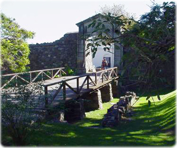
Puerta de la Ciudadela de Sacramento, an old Portuguese colony founded in the 17th century in Uruguay (photo Ministerio de Turismo del Uruguay).
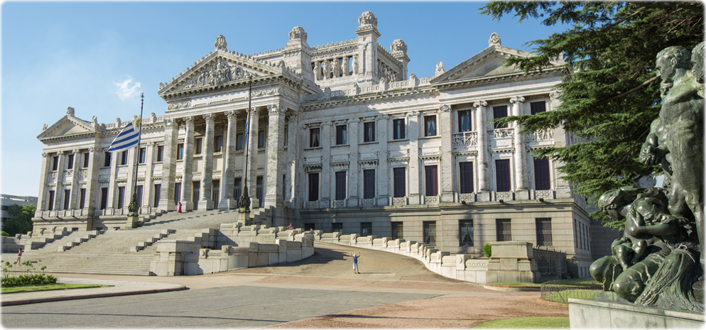
Palacio Legislativo in Montevideo (photo lvalin).
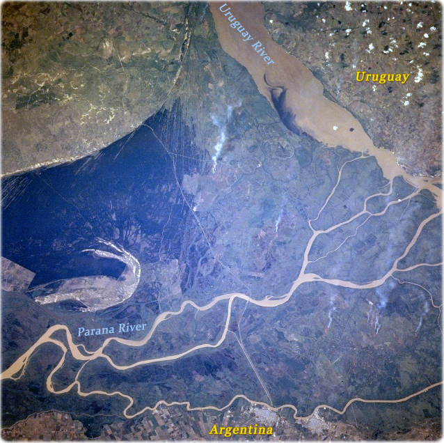
Uruguay river and Parana river delta (NASA Winter/Spring 1997, image at right). The Parana river has created a very broad delta and floodplain at the mouth of the river along the western end of the Rio de la Plata. The Uruguay river is visible in the upper right quadrant of the picture. The Uruguay River marks the border between Argentina and Uruguay.
|
Copyright © Geographic Guide - World in Pictures. American Continent. |
Images of Uruguay