Belgium
Belgium became independent from the Netherlands in 1830 and was occupied by Germany during World Wars I and II. It has prospered in the past half century as a modern, technologically advanced European state and member the European Union. Tensions between the Dutch-speaking Flemings of the north and the French-speaking Walloons of the south have led in recent years to constitutional amendments granting these regions formal recognition and autonomy. The capital is Brussels.
Terrain: flat coastal plains in northwest, central rolling hills, rugged mountains of Ardennes Forest in southeast. The highest point is Signal de Botrange 694 m.
Administrative divisions: 10 provinces (French: provinces, singular - province; Dutch: provincies, singular - provincie) and 3 regions (French: regions; Dutch: gewesten); Antwerpen, Brabant Wallon, Brussels (Bruxelles), Flanders, Hainaut, Liege, Limburg, Luxembourg, Namur, Oost-Vlaanderen, Vlaams-Brabant, Wallonia, West-Vlaanderen. Note: as a result of the 1993 constitutional revision that furthered devolution into a federal state, there are now three levels of government (federal, regional, and linguistic community) with a complex division of responsibilities.
Climate: Temperate; mild winters, cool summers; rainy, humid, cloudy.

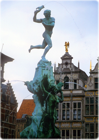
Brabo fountain in Antwerp.
Bruges


|
Copyright © Geographic Guide - World in Pictures. |