
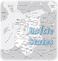
Map of Poland
Poland is an European country that has frontiers with Germany, Czech Republic, Slovakia, Lithuania, Ukraine, Belarus and the Russian exclave of Kaliningrad. Its terrain is mostly flat plain; mountains along southern border. The highest point is Rysy: 2,499 m. Provinces: Dolnoslaskie, Kujawsko-Pomorskie, Lodzkie (Lodz), Lubelskie (Lublin), Lubuskie (Lubusz), Malopolskie (Lesser Poland), Mazowieckie (Masovia), Opolskie (Opole), Podkarpackie (Subcarpathia), Podlaskie, Pomorskie (Pomerania), Slaskie (Silesia), Swietokrzyskie (Holy Cross), Warminsko-Mazurskie (Warmia-Masuria), Wielkopolskie and Zachodniopomorskie (West Pomerania).
The historic Neptune's Fountain, in Gdańsk, built in the 17th century.


|
Copyright © Geographic Guide - World in Pictures. European Continent. |