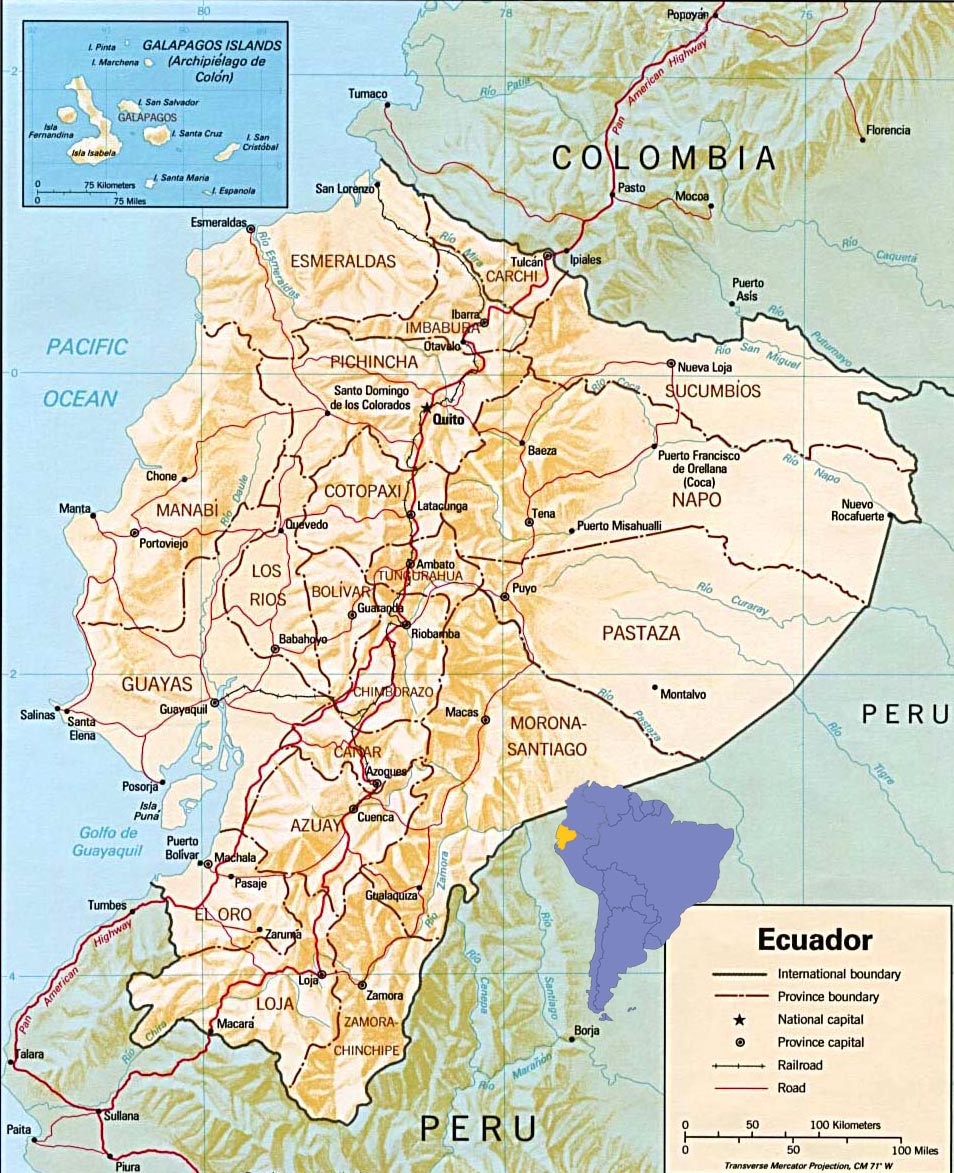
Ecuador Map
Ecuador is country bounded by Colombia on the north, by Peru on the east and south, and by the Pacific Ocean on the west. A highland region, the Sierra, crosses the central part of Ecuador from north to south. The Sierra consists of two parallel ranges (cordilleras) of the Andes and of upland basins, up to 65 km wide, that lie between the ranges. To the west of the Sierra is the Pacific coastal zone, the Costa. To the east of the Sierra is a part of the upper Amazon River basin, the eastern jungle.
Source: U.S. Central Intelligence Agency.

|
Copyright © Geographic Guide - World in Pictures, American Continent. All rights reserved |