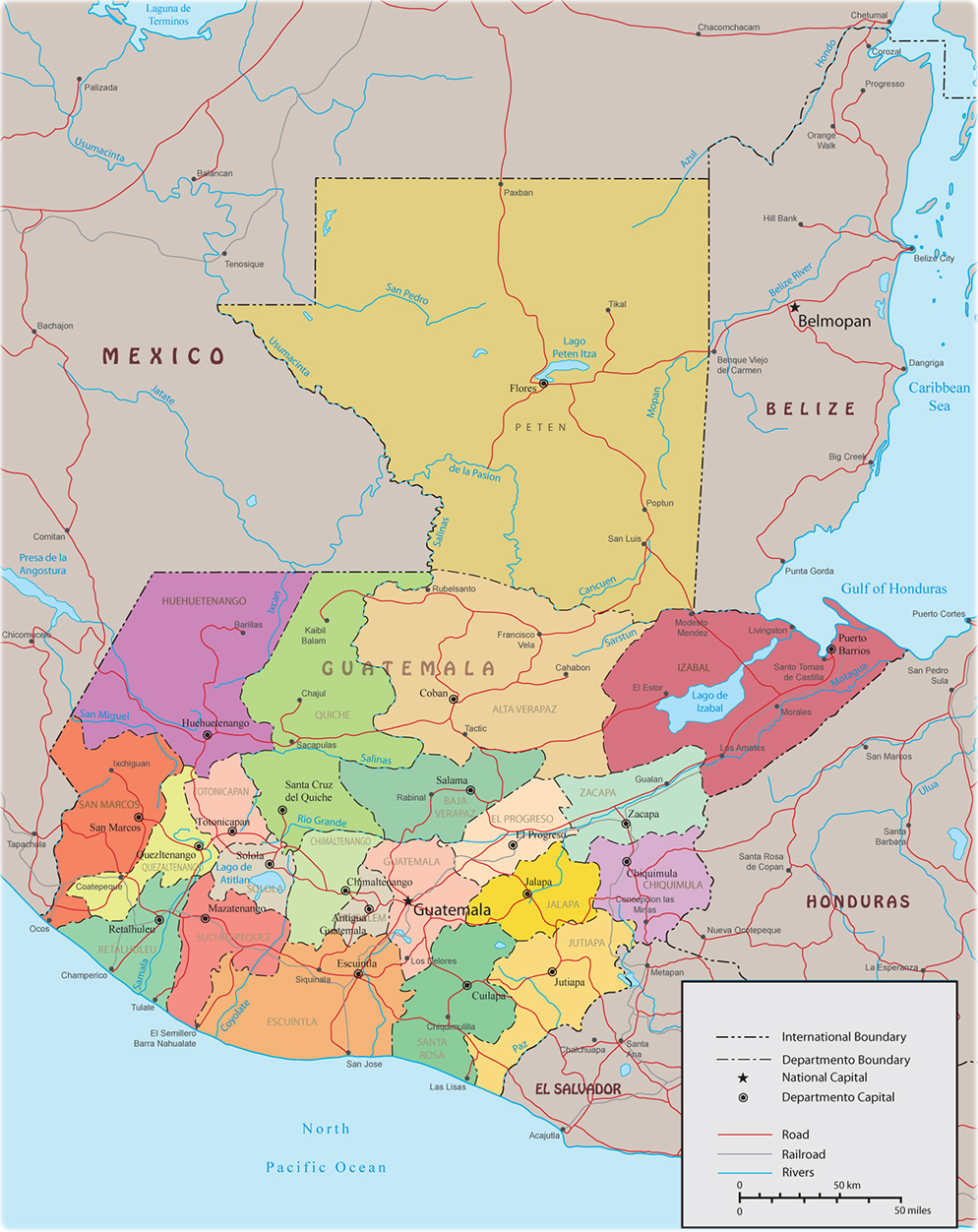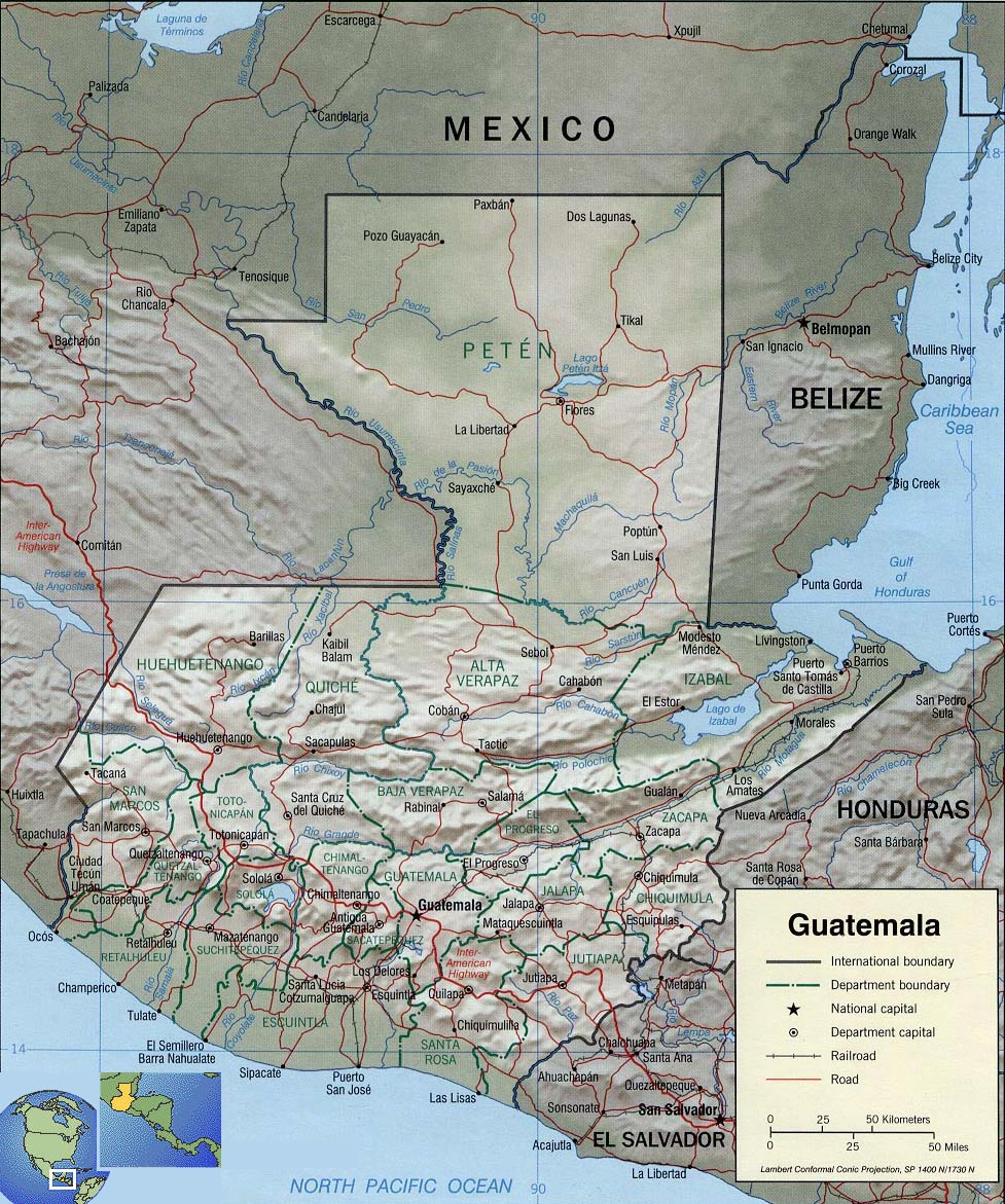
Physical Map of Guatemala

Guatemala was home to the heart of the Mayan civilization, which extended throughout Central America. In the 16th century, most of this territory was conquered by Spain and became part of the Viceroyalty of New Spain. Guatemala gained independence from Spain and Mexico in 1821. From 1823 to 1841, it was part of the Federal Republic of Central America. During the second half of the 19th century, Guatemala suffered from instability and civil conflict. From 1960 to 1996, Guatemala was the scene of a civil war. The United Nations negotiated peace, resulting in economic growth and democratic elections.

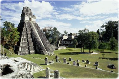
Ruins of Mayan temple and Plaza Major in Tikal, Guatemala. Tikal was one of the main centers of the pre-Columbian Maya civilization.

Source: U.S. Central Intelligence Agency.
Physical Map of Guatemala
|
Copyright © Geographic Guide - World in Pictures. American Continent. |