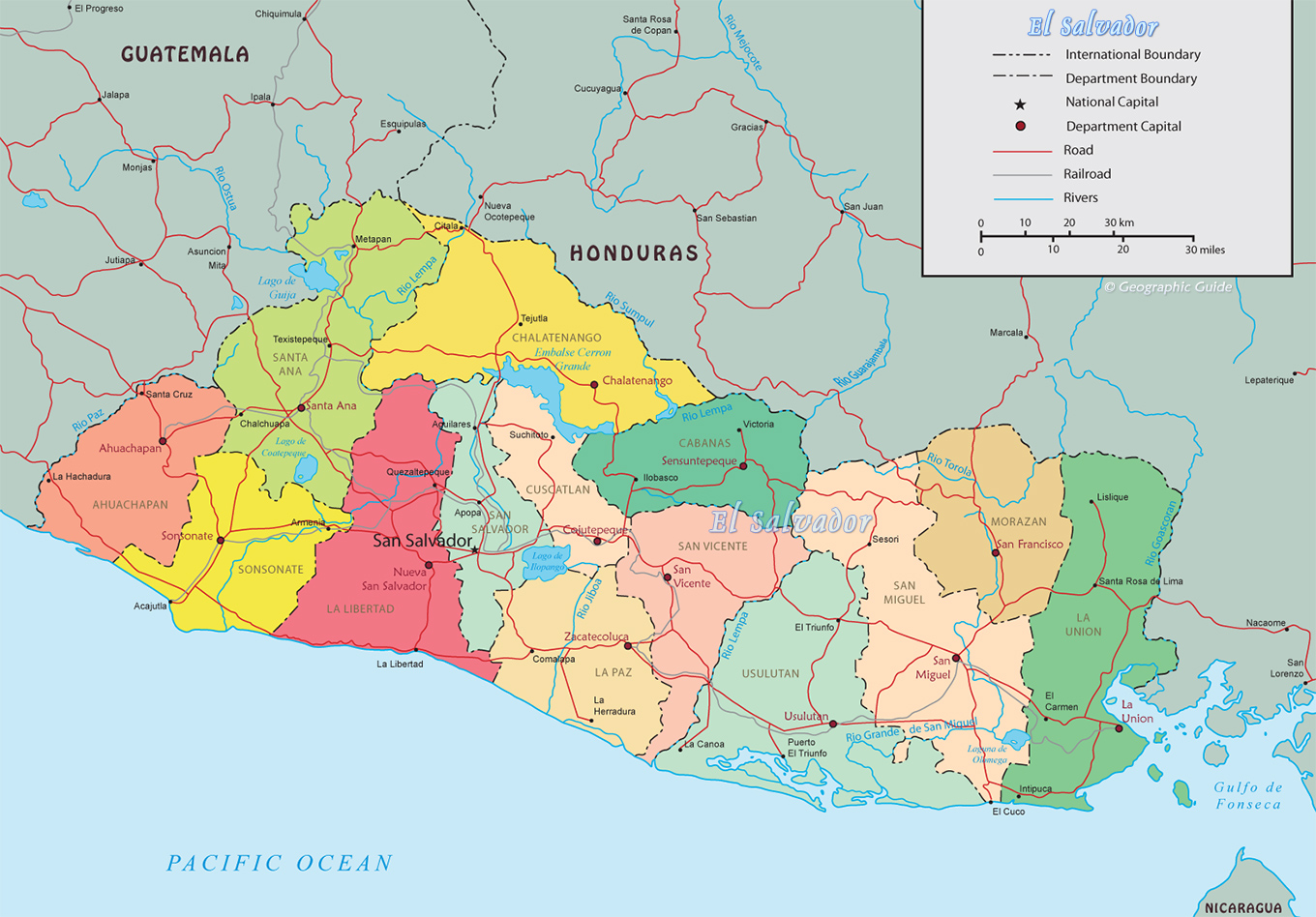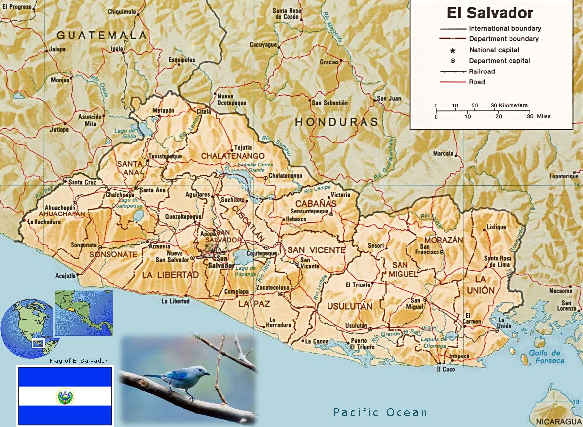
El Salvador Map
Central America
The Republic of El Salvador is divided into 14 departments: Ahuachapan, Cabanas, Chalatenango, Cuscatlan, La Libertad, La Paz, La Union, Morazan, San Miguel, San Salvador, San Vicente, Santa Ana, Sonsonate, Usuluta. The highest point of the country is Cerro El Pital 2,730 m. The major seaport is Puerto Cutuco. The country has border with Honduras and Guatemala.
Source: U.S. Central Intelligence Agency.
|
Copyright © Geographic Guide - World in Pictures, American Continent. |

Political Map
