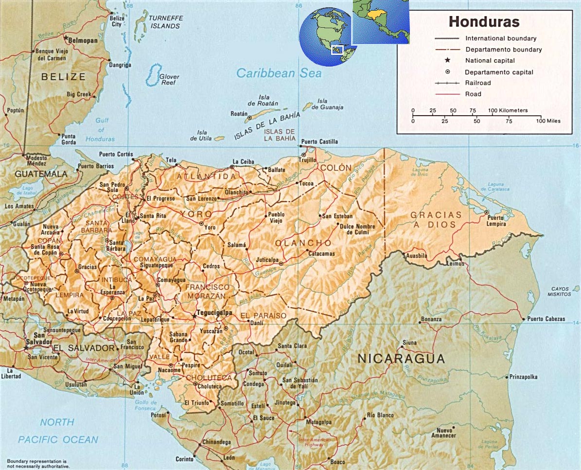
Map of Honduras
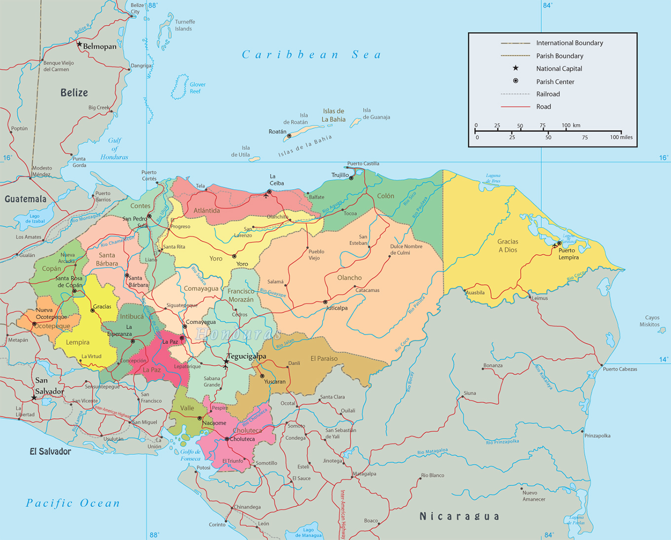
The Republic of Honduras is a country in Central America. It is bordered to the west by Guatemala, to the southwest by El Salvador, to the southeast by Nicaragua, to the south by the Pacific Ocean at the Gulf of Fonseca, and to the north by the Gulf of Honduras, a large inlet of the Caribbean Sea. Its capital and largest city is Tegucigalpa.


Political Map of Honduras
|
Copyright © Geographic Guide - World in Pictures, American Continent. |

Source: U.S. Central Intelligence Agency.