Map of Antarctica
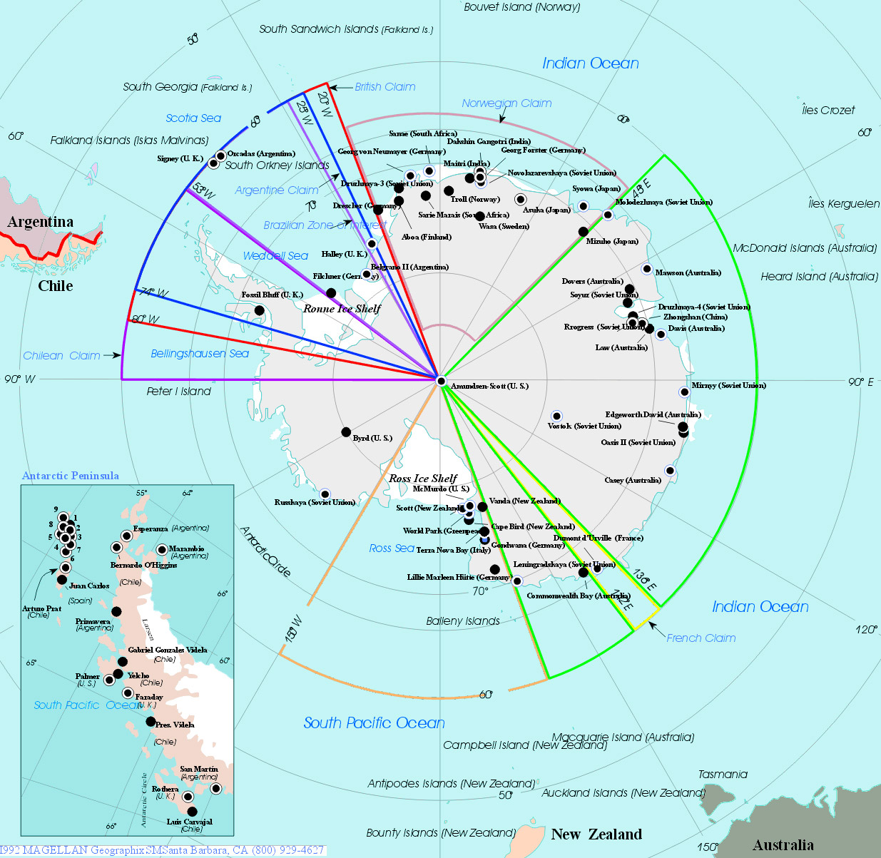
Antarctica is a continent at the South Pole of the Earth, surrounded by the Southern Ocean and divided into two by the Transantarctic Mountains. Antarctica is the coldest place on earth (the lowest temperature ever measured at the South Pole: -94.7° C) and the continent is almost completely covered with ice. It is also the continent with the lowest average humidity and it is the windiest and highest (average) continent on Earth. The continent's 14 million km² surface area makes it the fifth-largest continent on Earth and the largest desert in the world.
|
Copyright © Geographic Guide - World in Pictures, Continents. |
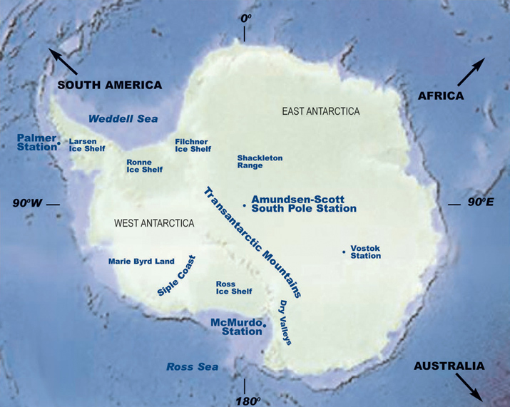
This map shows the location of the three permanent year-round stations operated by the U.S. Antarctic Program: McMurdo Station, Amundsen-Scott South Pole Station, and Palmer Station (source: NSF/USAP).
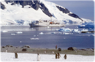
Penguins in Antarctica.