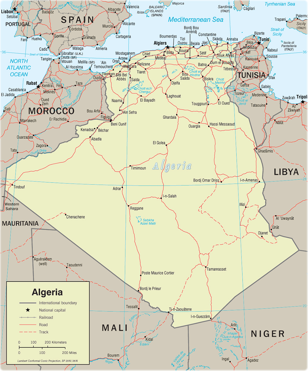
Political Map of Algeria
The People's Democratic Republic of Algeria (Al Jumhuriyah al Jaza'iriyah ad Dimuqratiyah ash Sha'biyah) is a country in northern Africa, bordering the Mediterranean Sea, between Morocco and Tunisia. Natural resources: petroleum, natural gas, iron ore, phosphates, uranium, lead and zinc. Pprovinces: Adrar, Ain Defla, Ain Temouchent, Alger, Annaba, Batna, Bechar, Bejaia, Biskra, Blida, Bordj Bou Arreridj, Bouira, Boumerdes, Chlef, Constantine, Djelfa, El Bayadh, El Oued, El Tarf, Ghardaia, Guelma, Illizi, Jijel, Khenchela, Laghouat, Mascara, Medea, Mila, Mostaganem, M'Sila, Naama, Oran, Ouargla, Oum el Bouaghi, Relizane, Saida, Setif, Sidi Bel Abbes, Skikda, Souk Ahras, Tebessa, Tiaret, Tindouf, Tipaza, Tissemsilt, Tizi Ouzou, Tlemcen and Tamanrasset.

|
Copyright © Geographic Guide - World in Pictures. African Continent. |

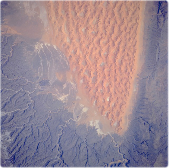
Tifernine Dunes (image left, July 1995) The Tassili N’ Ajjer of southeastern Algeria consists of large areas of sand dunes and substantial areas of sandstone bedrock outcrops. This photograph (NASA) vividly displays the differences between these two major landforms. The orange, complex, linear Tifernine Dunes with superimposed star dunes were named for the intermittently-flowing, south-to-north Tifernine watercourse along the southwestern extent of the dunes. This very distinctive alignment of sand dunes provides Space Shuttle astronauts a land reference in the much larger Sahara Desert. The dark, weathered sandstone rocks that border the Tifernine Dunes to the east and southwest have deep, narrow ravines that comprise a well-entrenched drainage pattern through the higher elevations of the plateau southwest of the dune field. This erosion process began millions of years ago when the climate was much wetter. This region now receives less than 2.5 cm of rainfall annually.
More in Africa: Cameroon , Western Sahara and Kenya.

Political Map of Algeria