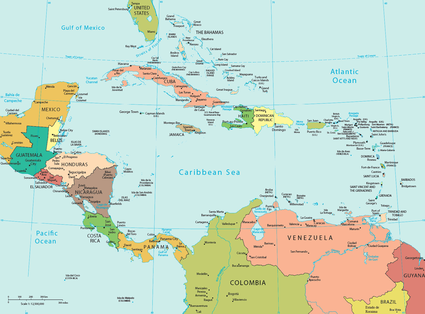
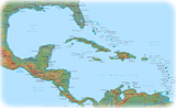
Political Map of Central America and The Caribbean
A peculiar characteristic of Central America is that of being a "bridge" between the North America and South America and at the same time an area of passage between the two major oceans of the Earth, the Pacific and the Atlantic, thanks to the presence of the Panama Canal.
The Antillean islands in the Caribbean are divided into two smaller groupings: the Greater Antilles and the Lesser Antilles. The Greater Antilles includes the larger islands of the Cayman Islands, Cuba, Hispaniola, Jamaica, and Puerto Rico. The Lesser Antilles contains the northerly Leeward Islands and the southeasterly Windward Islands as well as the Leeward Antilles just north of Venezuela.
◄ Maps
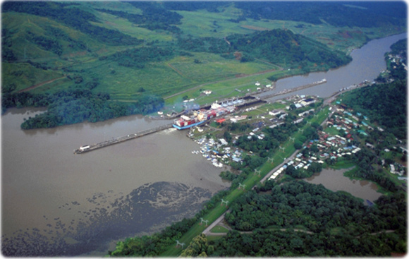
View of the Panama Canal (Miraflores). The Canal is 82 km long and runs from the city of Colon to Panama City.
|
Copyright © Geographic Guide - World in Pictures, American Continent. |
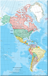
Map base: U.S. CIA