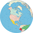
The Bahamas is a country made up of a chain of islands, a popular tourist destination. The Bahamas comprise an archipelago of about 700 islands and islets and nearly 2,400 cays. The Bahamas make up the northern end of an island chain called the West Indies that stretches through the Caribbean Sea all the way to South America.
The first place Christopher Columbus landed when he came to America, in 1492, was an island of the Bahamas. Columbus claimed the island for Spain and named it San Salvador. Historians are not sure which island Columbus landed on, but they think it may have been present-day San Salvador or Samana Cay. More: Map of Nassau ►
The Bahamas

Main towns: Nassau (capital, pop. 231,500 in 2006) on New Providence; Freeport (47,100), West End (12,900) and High Rock (3,800) on Grand Bahama; Cooper’s Town (8,600) and Marsh Harbour (5,400) on Abaco; Freetown (4,100) and Spanish Wells (1,800) on Eleuthera; Andros Town (2,400) on Andros; Clarence Town (1,700) on Long Island.
More: Antigua & Barbuda, St. Vincent & the Grenadines and St Kitts & Nevis

|
Copyright © Geographic Guide - World in Pictures, American Continent. |


The Bahamas