
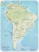
Political Map of Brazil
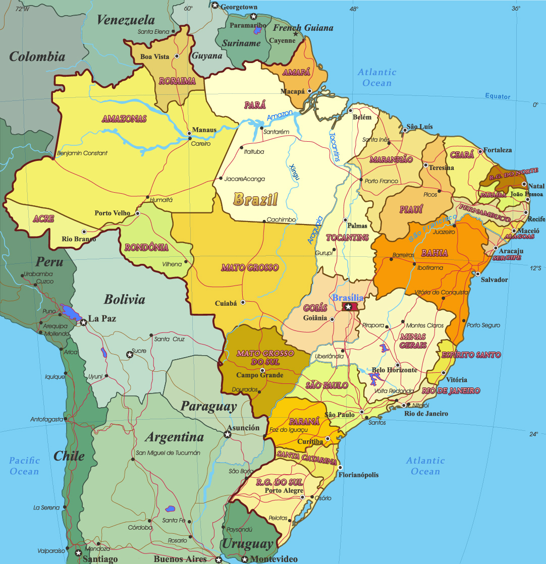
Brazil is the largest South American country. The capital is the modern Brasília. It is divided into 26 estates and one Federal District. The states are: Acre, Alagoas, Amapá, Amazonas, Bahia, Ceará, Espírito Santo, Goiás, Maranhão, Mato Grosso, Mato Grosso do Sul, Minas Gerais, Pará, Paraíba, Paraná, Pernambuco, Piauí, Rio Grande do Norte, Rio Grande do Sul, Rio de Janeiro, Rondônia, Roraima, Santa Catarina, São Paulo, Sergipe and Tocantins.
More: Maps of São Paulo ►

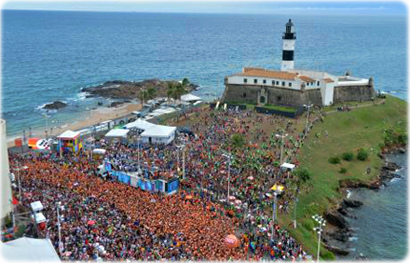
The biggest carnival of Planet Earth, with the participation of more than two million people in the city of Salvador. In the background, the Farol da Barra, the first lighthouse in America.
|
|
Copyright © Geographic Guide - World in Pictures, South America. |
Divulgação