
Images of South America
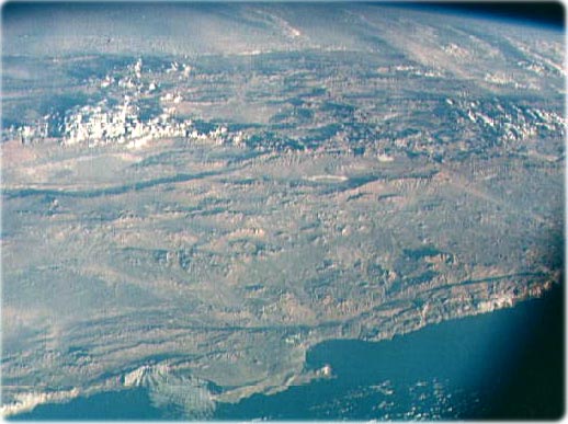
Chile, South America (image above) as seen from the Apollo 7 spacecraft, in October 1968, during its 81st revolution of the earth from an altitude of 120 nautical miles. The port city of Antofagasta, Chile, is located in the half-moon shaped bay in the lower left portion of the picture. Beyond the coast is the Andean peak of Liullaillaco Volcano which rises 22,000 ft above sea level. At left center is the Chuquicamata copper mines located near Coloma. At the center of the photo, behind the large salt lake and atop a 19,000 ft high volcano, the countries of Bolivia, Argentina, and Chile meet at a common point. Below the clouds in the upper portion of the photo are the great plains known as the Gran Chaco (NASA).
The Andes Mountains and northern Chile (NASA). The Andes is a mountain system with about 8,900 km from the southern tip of South America to the continent's northernmost coast on the Caribbean Sea.
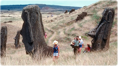
Tourists visiting the giant statues of Easter Island. Chilean territory in Oceania.
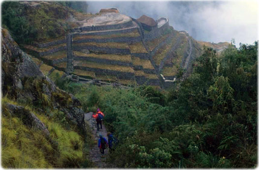
Ruins of Puyupatamarca, Inca Trail, Peru.
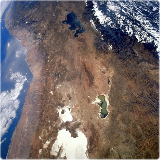
Central Andes Mountains (NASA - June 1993, image at right). The light tans and browns of the west coasts of northern Chile and Peru indicate an arid climate along the western foothills of the Andes Mountains. Many of the volcanic peaks in this mountainous zone exceed 5800 meters. Immediately east of the volcanic zone, the elevated plateau known as the Altiplano is apparent. This plateau, which averages 3600 m above sea level, stretches for approximately 400 km north-south, mostly in Bolivia, between the western and eastern cordilleras. Lake Titicaca, the world's highest navigable body of water (large lake to the north), is generally acknowledged as the northern limit of the Altiplano. The southern boundary (not shown in this photograph) is less well-defined, but it is generally accepted that the Altiplano ends south of an area with numerous salars (dry lakes). Smaller, greenish Lake Poopó was formed by interior drainage. Water levels fluctuate widely in this shallow, salty lake. The large, whitish features are salars; the smaller dry lake to the north is Salar de Coipasa, and the larger one is Salar de Uyuni. These salars are excellent landmarks for orbiting astronauts. Although difficult to discern at this scale, the capital city of La Paz, Bolivia, is located on the Altiplano southeast of Lake Titicaca. The parallel, mountainous ridges of the Cordillera Oriental border the Altiplano to the east. This is very rugged, mountainous terrain with many deeply incised streams creating severe canyons and valleys. Many of the ridges and peaks throughout this area exceed 4900 m in elevation. The pronounced drainage pattern southeast of Lake Titicaca results from the headwaters of the Rio Beni eroding a dendritic stream pattern in this section of the Altiplano. The Rio Madeira, which receives the waters of the Rio Beni, eventually flows into the Amazon, which empties into the Atlantic Ocean. Because of the elevation drop in the southwestern Amazon Basin, clouds have formed along the mountainous boundary, providing a significant clue to the impact the high Andes Mountains have on the climate of South America.
|
Copyright © Geographic Guide - World in Pictures. South America. |
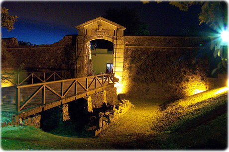
Puerta de la Ciudadela de Sacramento, an old Portuguese colony established in the 17th century in Uruguay. It was then considered part of Brazil (photo: divulgação).
Beach in Arembepe, northern coast of Bahia, Brazil (photo Christian Knepper).
Images of South America
