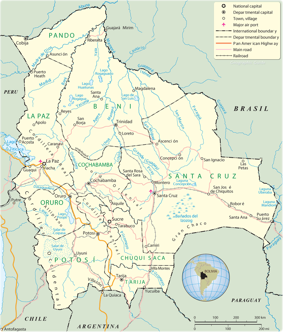
Map of Bolivia
Country Maps - Americas
Bolivia is a country South America. It has a landscape of snow-topped mountain peaks and broad, windswept plateaus, part of Andes Mountains. To the east of the mountains, vast grassy plains give way to lowland tropical rain forests. The official capital of Bolivia is Sucre; La Paz is the administrative capital and seat of government. At an altitude of about 3,600 m, La Paz is the highest capital in the world. Border with Argentina and Chile.
Most of Bolivia's people live on a plateau between two ranges of the Andes Mountains, which occupy a third of the country. Since the 1950s, however, the sparsely settled, eastern lowland plains have gradually become more heavily populated, in part because of discoveries of significant deposits of oil and natural gas there. In addition, the region's fertile farmland was opened to settlement. Santa Cruz, the region's center of trade and commerce, surpassed La Paz to become Bolivia's largest city in the early 2000s.
From the 16th to the early 19th century, Bolivia was a colony of Spain. The country became independent in 1825. In 1952 Bolivia underwent a political revolution. The leaders of that revolution introduced programs designed to provide greater political, economic, and social opportunities for Native Americans. The government extended the vote to all Native Americans, promoted education in rural villages, and redistributed land, breaking up the large estates established during colonial times and giving small plots of land to Native American farmers.
|
Copyright © Geographic Guide - World in Pictures, American Continent. |