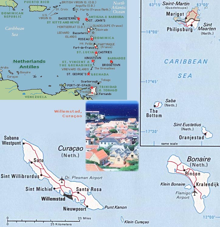
Netherlands Antilles Map - Dissolved in 2010
The former Netherlands Antilles was dissolved in October 2010. The three smallest islands: Bonaire, Sint Eustatius and Saba became special municipalities in the Netherlands administrative structure. The larger islands: Sint Maarten and Curacao joined the Netherlands and Aruba as constituent countries of the Kingdom of the Netherlands.

Country Maps - America
|
Copyright © Geographic Guide - World in Pictures, American Continent. |